Local guide from The Big Mack
Mount Elbert Hike: Routes, Distance and Difficulty from Twin Lakes
Compare the North, South, and Black Cloud Mount Elbert routes by distance, elevation gain, and time, plus season, weather, and altitude safety for planning your hike from Twin Lakes.

Mount Elbert is Colorado's highest peak at 14,433 feet, and the hike up it starts a short drive from Twin Lakes. Three official trails reach the summit: the North Mount Elbert Trail (4.3 miles one way, about 4,400 feet of gain), the South Mount Elbert Trail (5.8 miles one way, about 4,800 feet of gain), and the quieter Black Cloud Trail (5.5 miles one way, about 4,713 feet of gain). Every Mount Elbert route is a full, strenuous alpine day, not a casual walk.
Quick answer: which Mount Elbert route to hike
- North #1484: 4.3 mi one way, about 4,400 ft gain (USFS); about 8.6-9.75 mi round trip depending on source (USFS vs. 14ers.com/Visit Leadville Twin Lakes). Trailhead off Halfmoon Road; very heavily used on weekends.
- South #1481: 5.8 mi one way, about 4,800 ft gain (USFS), the longer standard route. Round trip depends on trailhead per 14ers.com: about 15 mi/5,000 ft from the lower 2WD trailhead on County Road 24, or about 11.25 mi/4,200 ft from the upper 4WD trailhead. USFS calls it the easier standard route and the winter route.
- Black Cloud #1480: 5.5 mi one way, about 4,713 ft gain (USFS); 14ers.com counts about 10.5 mi round trip, 5,300 ft total gain, Class 2 with moderate route-finding versus Class 1 for the others, the hardest and least-traveled option. Trailhead on Highway 82, 3.5 mi west of Twin Lakes Village.
- How long it takes: plan a full day on any route, starting at or before sunrise and off the summit, close to treeline, by noon.
- Best season: nearly all 14er hiking happens June through September, when snow melts off the popular routes (UCHealth); early-season trips can still mean snow up high.
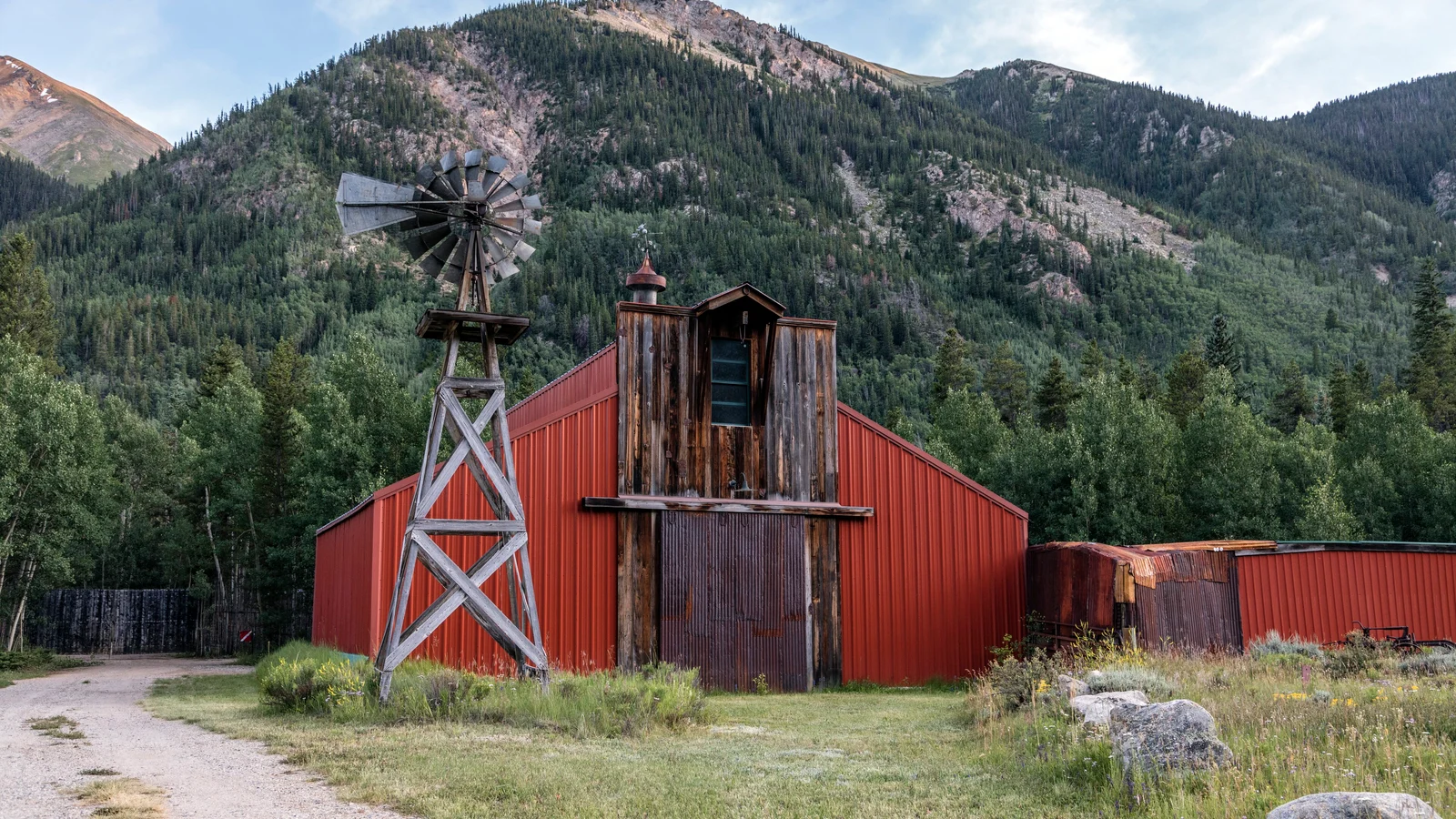
North Mount Elbert Trail: the shortest line on paper
The North Mount Elbert Trail shares a short stretch of the Colorado Trail (Segment 11) before splitting off toward the summit ridge. The Forest Service lists it at 4.3 miles one way with 4,400 feet of gain, the shorter of the two standard routes on paper. Shorter does not mean easy: the grade is steep throughout, and the Forest Service says the trailhead is very heavily used on weekends and moderately to heavily used on weekdays through summer and fall. For driving directions and parking, use the Mount Elbert trailhead planning guide. Read the Forest Service's North Mount Elbert Trail page before you go, since conditions change through the season.
South Mount Elbert Trail: the standard route
The South Mount Elbert Trail runs 5.8 miles one way with 4,800 feet of gain, the longer of the two standard routes on paper. The Forest Service calls it the easiest route to the summit for someone in reasonable physical condition and the standard winter route. The South Elbert Trailhead sits above Twin Lakes on County Road 24, off Highway 82; that paved 2WD trailhead is where most visitors without a high-clearance vehicle start, and 14ers.com's East Ridge route page puts the round trip from there at about 15 miles with 5,000 feet of total gain. Four-wheel-drive vehicles can sometimes continue 1.8 miles farther on Forest Service Road 125.B in summer, cutting the round trip to about 11.25 miles and 4,200 feet per 14ers.com, though that stretch is impassable in winter. Plan around the trailhead you can actually reach, not the shorter number. Check the Forest Service's South Mount Elbert Trail page before you choose a starting point. If your group wants another serious objective out of the Twin Lakes valley, the Hope Pass hike is worth comparing.
Black Cloud Trail: the quiet third option
The Black Cloud Trail climbs 5.5 miles one way with about 4,713 feet of gain per the Forest Service, from a trailhead on Highway 82 that the Forest Service places 3.5 miles west of Twin Lakes Village, across from Twin Peaks Campground. Because the route crosses intermediate terrain instead of climbing straight to the summit, 14ers.com's Black Cloud route page counts a higher total: about 10.5 miles round trip and 5,300 feet of gain, rated Class 2 with moderate route-finding versus Class 1 for the North and South trails. The Forest Service calls it an alternative to the busier standard trails, suited to experienced hikers comfortable finding their way on a less-traveled route, and notes there is no water along it. Read the Forest Service's Black Cloud Trail page before you commit to it.
How long does the Mount Elbert hike take?
The Visit Leadville Twin Lakes trail page lists the North route at 9.75 miles out and back with 4,393 feet of gain and more than 2 miles above treeline, close to the Forest Service's one-way figures above. Neither the Forest Service nor UCHealth publishes an hours estimate, so plan around two fixed points instead of a clock: a sunrise start, which the Forest Service calls ideal for beating afternoon storms, and being off the summit, close to treeline, by noon.
When to hike Mount Elbert
Nearly all 14er hiking happens June through September, when snow melts off the popular routes and the weather turns mild enough to attempt them, according to UCHealth. Early-season trips can still mean snow and postholing on the upper mountain even when Twin Lakes itself is clear, and afternoon thunderstorms are common through the summer months. Check the Leadville and Twin Lakes weather by month guide before you lock in dates, then recheck the forecast again the night before and the morning of your hike.
Weather, altitude, and turnaround time
A fourteener day starts early for a reason. Afternoon thunderstorms build quickly over the Sawatch Range, and the Forest Service advises getting below timberline at the first sign of one: be off the summit and close to treeline by noon. Altitude adds its own risk. Twin Lakes already sits well above 9,000 feet, and the summit is nearly a mile higher again; UCHealth notes that even people who live at Front Range elevations around 5,000 feet will likely feel short of breath, a headache, or some nausea on the way up, and that getting dizzy or forgetful is a sign to head down immediately. The Forest Service's standard advice is to combat altitude sickness by acclimating gradually and staying hydrated, so plan at least one easier day at Twin Lakes before a summit attempt, and descend immediately for severe headache, dizziness, or nausea. For a fuller look, see the Twin Lakes and Leadville altitude sickness guide. This page is planning guidance, not medical advice.
Build a turnaround plan before you start
- Check the forecast and the Forest Service's current alerts the night before you hike.
- Start at or before sunrise so your slowest hiker can be off the summit and close to treeline by noon.
- Set a firm turnaround time before you leave the trailhead, and agree as a group to honor it.
- Carry rain and wind layers, extra food and water, and a downloaded map or route, since both weather and cell service can fail above treeline.
- Turn around for thunder, building clouds, altitude symptoms, or a missed time target, even close to the top.
Current conditions, parking, and closures
Conditions in the Leadville Ranger District change through the season, and this year that includes an active fire closure. As of October 1, 2026, Forest Order 02-12-01-26-39, the Willow Fire area closure in effect through December 31, 2026, closes National Forest System land on Mount Massive's eastern slope, north of Halfmoon Creek and next to the Halfmoon Road corridor leading to the North Elbert trailhead. Check the Willow Fire area closure order and the Pike and San Isabel alerts page for the current closure map before you drive out. For North (Halfmoon Road) trailhead directions and parking, use the Mount Elbert trailhead planning guide; for South and Black Cloud, the Forest Service route pages above carry current access details. This page does not claim any trail, road, or trailhead is open today.
If part of the group wants an easier day
None of the Mount Elbert routes, North, South, or Black Cloud, is a beginner hike or a safe default for young kids or a first high-altitude day. If part of your group wants a shorter, lower-elevation outing instead of a full summit attempt, the Twin Lakes and Leadville things-to-do guide has lower-commitment options around the lake and in town for the day.
Make Twin Lakes the base for the whole group
The Big Mack sleeps 12 across four bedrooms, just across the road from Twin Lakes and a short drive from all three Mount Elbert trailheads, so a summit team, an easier-trail group, and a rest-day group can share one house without sharing one risk tolerance. Come back from a 4,000-plus-foot day to a hot tub, a full kitchen, and a fireplace instead of a long drive back to town. Check your dates and book direct.

